
Vaizdas:Map of the partition of the Kingdom of Poland and the Grand Duchy of Lithuania from 1799.jpg

Šios peržiūros dydis: 669 × 600 taškų. Kitos 6 rezoliucijos: 268 × 240 taškų | 535 × 480 taškų | 856 × 768 taškų | 1 142 × 1 024 taškų | 2 284 × 2 048 taškų | 6 330 × 5 677 taškų.
Didesnės raiškos iliustracija (6 330 × 5 677 taškų, rinkmenos dydis: 6,83 MiB, MIME tipas: image/jpeg)
| Ši byla yra iš bendros Wikimedia Commons nemokamų resursų duomenų bazės, palaikomos Wikimedia Foundation organizacijos. Norėdami sužinoti licencijavimo smulkmenas, žiūrėkite paveikslėlio aprašymą |  |
Į paveikslėlio aprašymą |
Aprašymas
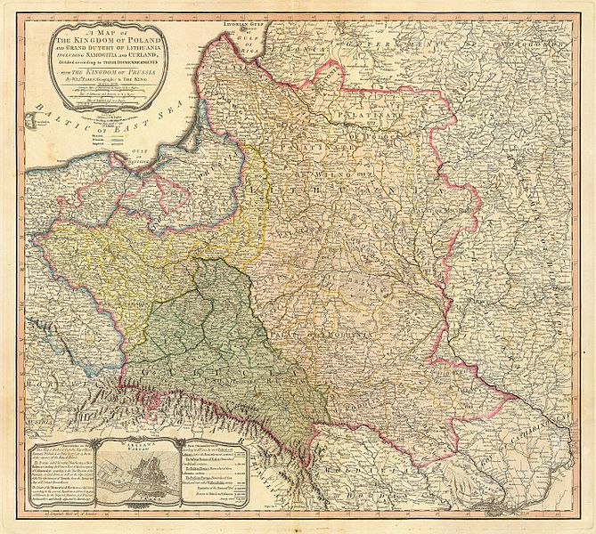
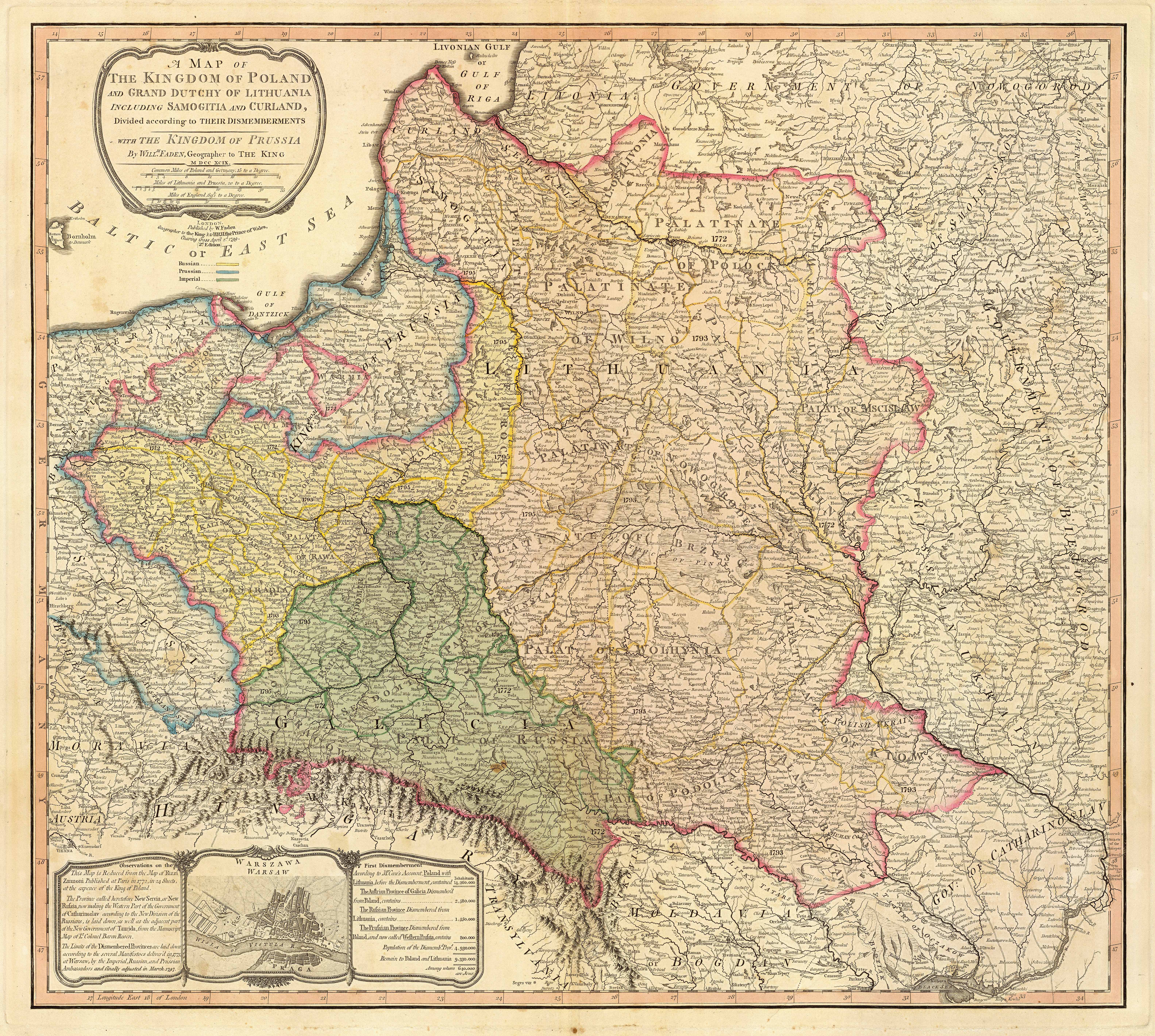
| Aprašymas | Title: "A map of the Kingdom of Poland and the Grand Duchy of Lithuania including Samogitia and Curland divided according to their dismemberments with the Kingdom of Prussia". A map from 1799 showing how the Polish-Lithuanian Commonwealth was partitioned in 1765-1795 between Prussia, Austria, and Russia. This is an extremely detailed map which lists all the cities and small towns and labels the regions according to their English names. The boundaries former Polish-Lithuanian Commonwealth colored light red. The areas taken by Prussia are colored yellow, those taken by Austria colored green, and those taken by Russia are colored beige. Prussia itself is bordered in blue. Eastern Pomerania and Warmia are shown as part of Prussia but bordered in red as well. | ||||||||||||||||||||||
| Data | |||||||||||||||||||||||
| Šaltinis | http://www.belarusguide.com/images/maps/Kokosha/POlonia&Lituania-1799.jpg | ||||||||||||||||||||||
| Autorius |
|
||||||||||||||||||||||
Licencija
|
Šis failas yra viešo naudojimo tose šalyse, kuriose autorių teisės galiojimo netenka po 100 metų nuo autoriaus mirties. | |
| This file has been identified as being free of known restrictions under copyright law, including all related and neighboring rights. | |
Rinkmenos istorija
Paspauskite ant datos/laiko, kad pamatytumėte rinkmeną tokią, kokia ji buvo tuo metu.
| Data/Laikas | Miniatiūra | Matmenys | Naudotojas | Paaiškinimas | |
|---|---|---|---|---|---|
| dabartinis | 08:04, 23 rugsėjo 2007 | | 6 330 × 5 677 (6,83 MiB) | Archaeogenetics | {{Information |Description=Title: "A map of the Kingdom of Poland and the Grand Duchy of Lithuania including Samogitia and Curland divided according to their dismemberments with the Kingdom of Prussia". A map from 1799 showing how the Polish-Lithuanian Co |
Paveikslėlio naudojimas
Paveikslėlis yra naudojamas šiuose puslapiuose:
Visuotinis rinkmenos naudojimas
Ši rinkmena naudojama šiose viki svetainėse:
- Naudojama en.wikipedia.org
- Naudojama et.wikipedia.org
- Naudojama lt.wikibooks.org
- Naudojama pnb.wikipedia.org
- Naudojama th.wikipedia.org
- Naudojama uk.wikipedia.org
- Naudojama ur.wikipedia.org
- Naudojama zh.wikipedia.org