
Vaizdas:Kanal-mazurski-profil.png

Didesnės raiškos iliustracija (2 444 × 1 860 taškų, rinkmenos dydis: 248 KiB, MIME tipas: image/png)
| Ši byla yra iš bendros Wikimedia Commons nemokamų resursų duomenų bazės, palaikomos Wikimedia Foundation organizacijos. Norėdami sužinoti licencijavimo smulkmenas, žiūrėkite paveikslėlio aprašymą |  |
Į paveikslėlio aprašymą |
Aprašymas
| Aprašymas |
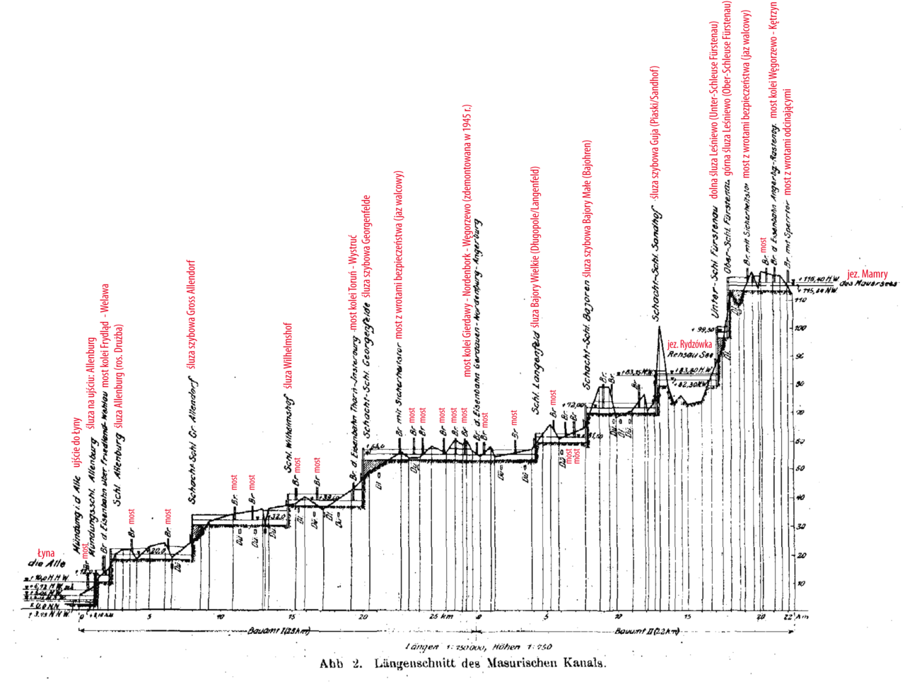
English: longitudinal profile of the Masurian Canal in Northeast Poland (until 1945 south of East Prussia in Germany) Polski: Profil wysokościowy Kanału Mazurskiego. Zawiera wszystkie śluzy i jazy na szlaku kanału. |
| Data | |
| Šaltinis | Der Maurische Kanal: Zweckbestimmung und Entstehungsgeschichte, Linienführung und Längenschnitt, Wasserwirtschaft. (1916). Zentralblatt der Bauverwaltung, [online] 83(36), pp.5-8. Available at: http://nbn-resolving.de/urn:nbn:de:kobv:109-opus-50506. |
| Autorius | Ziegler, polish annotations: Lyck |
| Kitos versijos | Derivative works of this file: Masurischer Kanal Profil 001.png |
Licencija
|
Šis failas yra viešo naudojimo tose šalyse, kuriose autorių teisės galiojimo netenka po 70 metų nuo autoriaus mirties.
| |
| This file has been identified as being free of known restrictions under copyright law, including all related and neighboring rights. | |
Rinkmenos istorija
Paspauskite ant datos/laiko, kad pamatytumėte rinkmeną tokią, kokia ji buvo tuo metu.
| Data/Laikas | Miniatiūra | Matmenys | Naudotojas | Paaiškinimas | |
|---|---|---|---|---|---|
| dabartinis | 01:05, 4 gruodžio 2008 | | 2 444 × 1 860 (248 KiB) | Lyck~commonswiki | ({{Information |Description={{en|1=longitudinal profile of the Masurian Canal in Northeast Poland (until 1945 south of East Prussia in Germany)}} {{pl|1=Profil wysokościowy Kanału Mazurskiego. Zawiera wszystkie śluzy i jazy na szlaku kanału.}} |Source |
Paveikslėlio naudojimas
Paveikslėlis nenaudojamas nei viename straipsnyje.