
Vaizdas:-Ringsted.jpg

Didesnės raiškos iliustracija (793 × 1 139 taškų, rinkmenos dydis: 598 KiB, MIME tipas: image/jpeg)
| Ši byla yra iš bendros Wikimedia Commons nemokamų resursų duomenų bazės, palaikomos Wikimedia Foundation organizacijos. Norėdami sužinoti licencijavimo smulkmenas, žiūrėkite paveikslėlio aprašymą |  |
Į paveikslėlio aprašymą |
| Aprašymas |
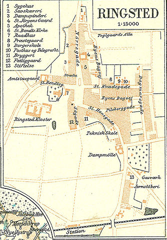
Dansk: Kort over Ringsted omkring 1900
English: Map of Ringstedin Denmark |
||||
| Data | circa 1900 m. | ||||
| Šaltinis | Frems Amtskort over Danmark | ||||
| Autorius | Fotolitograferede i Generalstabens Topografiske Afdeling | ||||
| Leidimas (Šios rinkmenos panaudojimas kitur) |
|
||||
| Kitos versijos | Derivative works of this file: Sorø ca 1900.jpg used in da:Sorø Amt, | ||||
| This is a retouched picture, which means that it has been digitally altered from its original version. Modifications: Ringsted omkring 1900. The original can be viewed here: Soroe Amt.jpg:
|
Rinkmenos istorija
Paspauskite ant datos/laiko, kad pamatytumėte rinkmeną tokią, kokia ji buvo tuo metu.
| Data/Laikas | Miniatiūra | Matmenys | Naudotojas | Paaiškinimas | |
|---|---|---|---|---|---|
| dabartinis | 12:04, 13 balandžio 2009 | | 793 × 1 139 (598 KiB) | Cropbot | {{Information |Description=da:Kort over Sorø Amt <br/>en:Map of Sorø County in Denmark |Source=''Frems Amtskort over Danmark'' |Date=ca. 1900 |Author= Fotolitograferede i Generalstabens Topografiske Afdeling |Permission={{PD-old}} |other_versions={{Der |
Paveikslėlio naudojimas
Paveikslėlis yra naudojamas šiuose puslapiuose:
Visuotinis rinkmenos naudojimas
Ši rinkmena naudojama šiose viki svetainėse:
- Naudojama da.wikipedia.org
- Naudojama nl.wikipedia.org