
Vaizdas:1922 world map.png
Šios peržiūros dydis: 800 × 543 taškų. Kitos 6 rezoliucijos: 320 × 217 taškų | 640 × 435 taškų | 1 024 × 696 taškų | 1 280 × 869 taškų | 2 560 × 1 739 taškų | 3 495 × 2 374 taškų.
Didesnės raiškos iliustracija (3 495 × 2 374 taškų, rinkmenos dydis: 17,29 MiB, MIME tipas: image/png)
| Ši byla yra iš bendros Wikimedia Commons nemokamų resursų duomenų bazės, palaikomos Wikimedia Foundation organizacijos. Norėdami sužinoti licencijavimo smulkmenas, žiūrėkite paveikslėlio aprašymą |  |
Į paveikslėlio aprašymą |
Aprašymas
| Aprašymas |
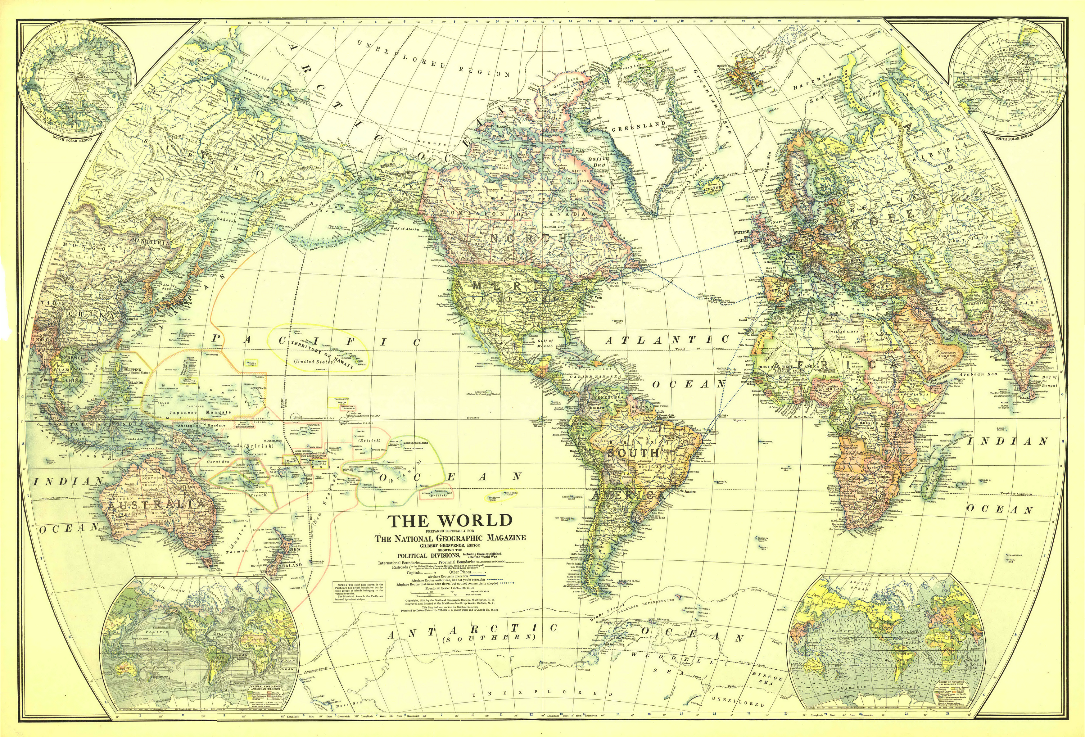
English: Map of the World in 1922
Drawn with Van der Grinten projection. Scale on equator 1 inch = 625 miles (1 : 39,600,000) Extra maps in the corners: North and South polar regions, natural vegetation and ocean currents, density of population and prevailing winds. |
| Data | |
| Šaltinis | The Complete National Geographic Maps Collection (CD-ROM set owned by Angr) |
| Autorius | National Geographic Society |
| Leidimas (Šios rinkmenos panaudojimas kitur) |
Copyright expired |
Licencija
This media file is in the public domain in the United States. This applies to U.S. works where the copyright has expired, often because its first publication occurred prior to January 1, 1929, and if not then due to lack of notice or renewal. See this page for further explanation.
|
 | |
 |
This image might not be in the public domain outside of the United States; this especially applies in the countries and areas that do not apply the rule of the shorter term for US works, such as Canada, Mainland China (not Hong Kong or Macao), Germany, Mexico, and Switzerland. The creator and year of publication are essential information and must be provided. See Wikipedia:Public domain and Wikipedia:Copyrights for more details.
|
Rinkmenos istorija
Paspauskite ant datos/laiko, kad pamatytumėte rinkmeną tokią, kokia ji buvo tuo metu.
| Data/Laikas | Miniatiūra | Matmenys | Naudotojas | Paaiškinimas | |
|---|---|---|---|---|---|
| dabartinis | 11:08, 15 rugsėjo 2006 | | 3 495 × 2 374 (17,29 MiB) | Mahagaja | {{Information |Description=Map of the World in 1922 |Source=National Geographic maps collection (CD-ROM set owned by User:Angr |Date=December 1922 |Author=National Geographic Society |Permission=Public domain }} ==Licensing== {{PD-US}} [[Category:O |
Paveikslėlio naudojimas
Paveikslėlis nenaudojamas nei viename straipsnyje.
Visuotinis rinkmenos naudojimas
Ši rinkmena naudojama šiose viki svetainėse:
- Naudojama de.wikipedia.org
- Naudojama en.wikipedia.org
- Naudojama eo.wikipedia.org
- Naudojama id.wikipedia.org