
Vaizdas:1850 Mitchell Map of Austria, Hungary and Transylvania - Geographicus - Austria-mitchell-1850.jpg

Šios peržiūros dydis: 755 × 600 taškų. Kitos 6 rezoliucijos: 302 × 240 taškų | 604 × 480 taškų | 967 × 768 taškų | 1 280 × 1 017 taškų | 2 560 × 2 033 taškų | 3 000 × 2 383 taškų.
Didesnės raiškos iliustracija (3 000 × 2 383 taškų, rinkmenos dydis: 2,31 MiB, MIME tipas: image/jpeg)
| Ši byla yra iš bendros Wikimedia Commons nemokamų resursų duomenų bazės, palaikomos Wikimedia Foundation organizacijos. Norėdami sužinoti licencijavimo smulkmenas, žiūrėkite paveikslėlio aprašymą |  |
Į paveikslėlio aprašymą |
| Samuel Augustus Mitchell: Austrian Empire.
( |
||||||||||||||||||||
|---|---|---|---|---|---|---|---|---|---|---|---|---|---|---|---|---|---|---|---|---|
| Autorius |
|
|||||||||||||||||||
| Pavadinimas |
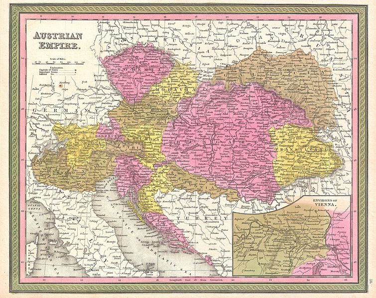
Austrian Empire. |
|||||||||||||||||||
| Aprašymas |
English: An extremely attractive example of S. A. Mitchell Sr.’s 1850 map of the Austrian Empire. Includes much of today's Austria, Hungary, Romania, Albania, Serbia and Croatia. Depicts the entire country color coded according to individual states. Lower right quadrant features an inset map of the Environs of Vienna. Surrounded by the green border common to Mitchell maps from the 1850s. Prepared by S. A. Mitchell for issued as plate no. 56 in the 1850 edition of his New Universal Atlas . |
|||||||||||||||||||
| Data | 1850 m. (undated) | |||||||||||||||||||
| Matmenys | aukštis: 12 in (30,4 cm); plotis: 15 in (38,1 cm) | |||||||||||||||||||
| Leidimo numeris |
Geographicus link: Austria-mitchell-1850 |
|||||||||||||||||||
| Šaltinis/Fotografas |
Mitchell Sr., S. A.,A New Universal Atlas Containing Maps of the various Empires, Kingdoms, States and Republics Of The World. (1850 issue)
|
|||||||||||||||||||
| Leidimas (Šios rinkmenos panaudojimas kitur) |
|
|||||||||||||||||||
Rinkmenos istorija
Paspauskite ant datos/laiko, kad pamatytumėte rinkmeną tokią, kokia ji buvo tuo metu.
| Data/Laikas | Miniatiūra | Matmenys | Naudotojas | Paaiškinimas | |
|---|---|---|---|---|---|
| dabartinis | 04:09, 23 kovo 2011 | | 3 000 × 2 383 (2,31 MiB) | BotMultichillT | {{subst:User:Multichill/Geographicus |link=http://www.geographicus.com/P/AntiqueMap/Austria-mitchell-1850 |product_name=1850 Mitchell Map of Austria, Hungary and Transylvania |map_title=Austrian Empire. |description=An extremely attractive example of S. A |
Paveikslėlio naudojimas
Paveikslėlis nenaudojamas nei viename straipsnyje.
Visuotinis rinkmenos naudojimas
Ši rinkmena naudojama šiose viki svetainėse:
- Naudojama en.wikipedia.org
- Naudojama es.wikipedia.org
- Naudojama hr.wikipedia.org
- Naudojama sh.wikipedia.org
- Naudojama uk.wikipedia.org