
Vaizdas:Pola - 32-45.jpg
Didesnės raiškos iliustracija (3 581 × 4 932 taškų, rinkmenos dydis: 3,17 MiB, MIME tipas: image/jpeg)
| Ši byla yra iš bendros Wikimedia Commons nemokamų resursų duomenų bazės, palaikomos Wikimedia Foundation organizacijos. Norėdami sužinoti licencijavimo smulkmenas, žiūrėkite paveikslėlio aprašymą |  |
Į paveikslėlio aprašymą |
|
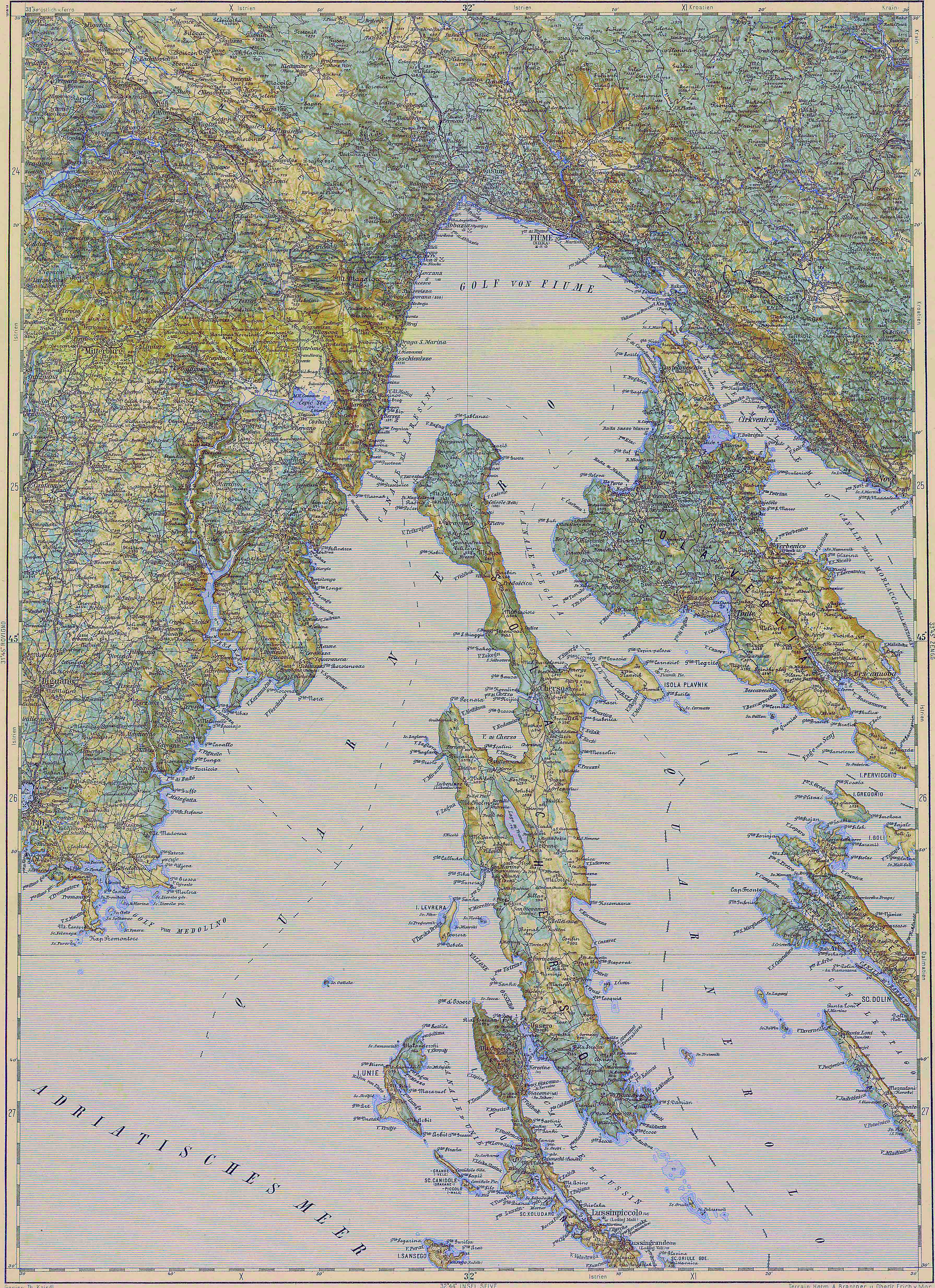
Deutsch: Blatt 32-45 der Generalkarte von Mitteleuropa 1:200.000 der Franzisco-Josephinischen Landesaufnahme, Österreich-Ungarn, ab 1887. Die Blattmitte liegt bei 45° n.Br. und 32° ö.L. (östlich von Ferro, nicht Greenwich!). English: Sheet 32-45 of the General Map of Central Europe, scale 1:200,000, edited 1887 ff. See 3rd Military Mapping Survey of Austria-Hungary for details. The center of the sheet is 45° North, 32° East (east of Ferro, not Greenwich!).
← Nachbarblätter. Klicken Sie auf eine Miniatur, um zu diesem Blatt zu gelangen.
← Neighbouring sheets. Click thumbnail to navigate |


.jpg)
Aprašymas
| Aprašymas | 3rd Military Mapping Survey of Austria-Hungary - Pola |
| Data | circa 1910 m. |
| Šaltinis | http://lazarus.elte.hu/hun/moterkep.htm - László ZENTAI |
| Autorius | Military mapping authority of Austria-Hungary |
Licencija
|
Šis failas yra viešo naudojimo tose šalyse, kuriose autorių teisės galiojimo netenka po 70 metų nuo autoriaus mirties.
| |
| This file has been identified as being free of known restrictions under copyright law, including all related and neighboring rights. | |
Rinkmenos istorija
Paspauskite ant datos/laiko, kad pamatytumėte rinkmeną tokią, kokia ji buvo tuo metu.
| Data/Laikas | Miniatiūra | Matmenys | Naudotojas | Paaiškinimas | |
|---|---|---|---|---|---|
| dabartinis | 09:40, 18 lapkričio 2007 | | 3 581 × 4 932 (3,17 MiB) | Szilas | |
| 16:16, 14 kovo 2007 |  | 3 581 × 4 932 (4,13 MiB) | Szilas | == Összefoglaló == 3rd Military Mapping Survey of Austria-Hungary - Pola Source: http://lazarus.elte.hu/hun/moterkep.htm - László ZENTAI Category:3rd Military Mapping Survey of Austria-Hungary == Licensing == {{PD-old}} |
Paveikslėlio naudojimas
Paveikslėlis yra naudojamas šiuose puslapiuose:
Visuotinis rinkmenos naudojimas
Ši rinkmena naudojama šiose viki svetainėse:
- Naudojama de.wikivoyage.org
- Naudojama es.wikipedia.org
- Naudojama hu.wikipedia.org
- Naudojama hu.wikibooks.org
- Naudojama it.wikipedia.org
- Naudojama sh.wikipedia.org