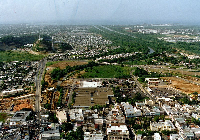
Vaizdas:Bayamon Puerto Rico aerial view.jpg

Šios peržiūros dydis: 800 × 559 taškų. Kitos 5 rezoliucijos: 320 × 223 taškų | 640 × 447 taškų | 1 024 × 715 taškų | 1 280 × 894 taškų | 1 504 × 1 050 taškų.
Didesnės raiškos iliustracija (1 504 × 1 050 taškų, rinkmenos dydis: 413 KiB, MIME tipas: image/jpeg)
Rinkmenos istorija
Paspauskite ant datos/laiko, kad pamatytumėte rinkmeną tokią, kokia ji buvo tuo metu.
| Data/Laikas | Miniatiūra | Matmenys | Naudotojas | Paaiškinimas | |
|---|---|---|---|---|---|
| dabartinis | 04:35, 27 balandžio 2007 |  | 1 504 × 1 050 (413 KiB) | DanMS | {{Information | Description = {{en|Aerial view of Bayamón, Puerto Rico. The U.S. Army Corps of Engineers has constructed a flood control project on the Rio de Bayamón through the city. View is to the north towards the Atlantic Ocean. The Canton Mall |
Paveikslėlio naudojimas
Paveikslėlis yra naudojamas šiuose puslapiuose:
Visuotinis rinkmenos naudojimas
Ši rinkmena naudojama šiose viki svetainėse:
- Naudojama ar.wikipedia.org
- Naudojama azb.wikipedia.org
- Naudojama bg.wikipedia.org
- Naudojama ca.wikipedia.org
- Naudojama ceb.wikipedia.org
- Naudojama cs.wikipedia.org
- Naudojama de.wikivoyage.org
- Naudojama el.wikipedia.org
- Naudojama en.wikipedia.org
- Naudojama en.wikivoyage.org
- Naudojama eo.wikipedia.org
- Naudojama es.wikipedia.org
- Naudojama fr.wikipedia.org
- Naudojama it.wikipedia.org
- Naudojama ja.wikipedia.org
- Naudojama ka.wikipedia.org
- Naudojama ko.wikipedia.org
- Naudojama la.wikipedia.org
- Naudojama lld.wikipedia.org
- Naudojama mk.wikipedia.org
- Naudojama nl.wikipedia.org
- Naudojama no.wikipedia.org
- Naudojama os.wikipedia.org
- Naudojama pl.wikipedia.org
- Naudojama pl.wikivoyage.org
- Naudojama pt.wikipedia.org
- Naudojama ru.wikipedia.org
- Naudojama simple.wikipedia.org
- Naudojama sr.wikipedia.org
- Naudojama sv.wikipedia.org
- Naudojama trv.wikipedia.org
- Naudojama tr.wikipedia.org
- Naudojama uk.wikipedia.org
- Naudojama www.wikidata.org
- Naudojama zh.wikipedia.org


